 Tour de Scandinavie


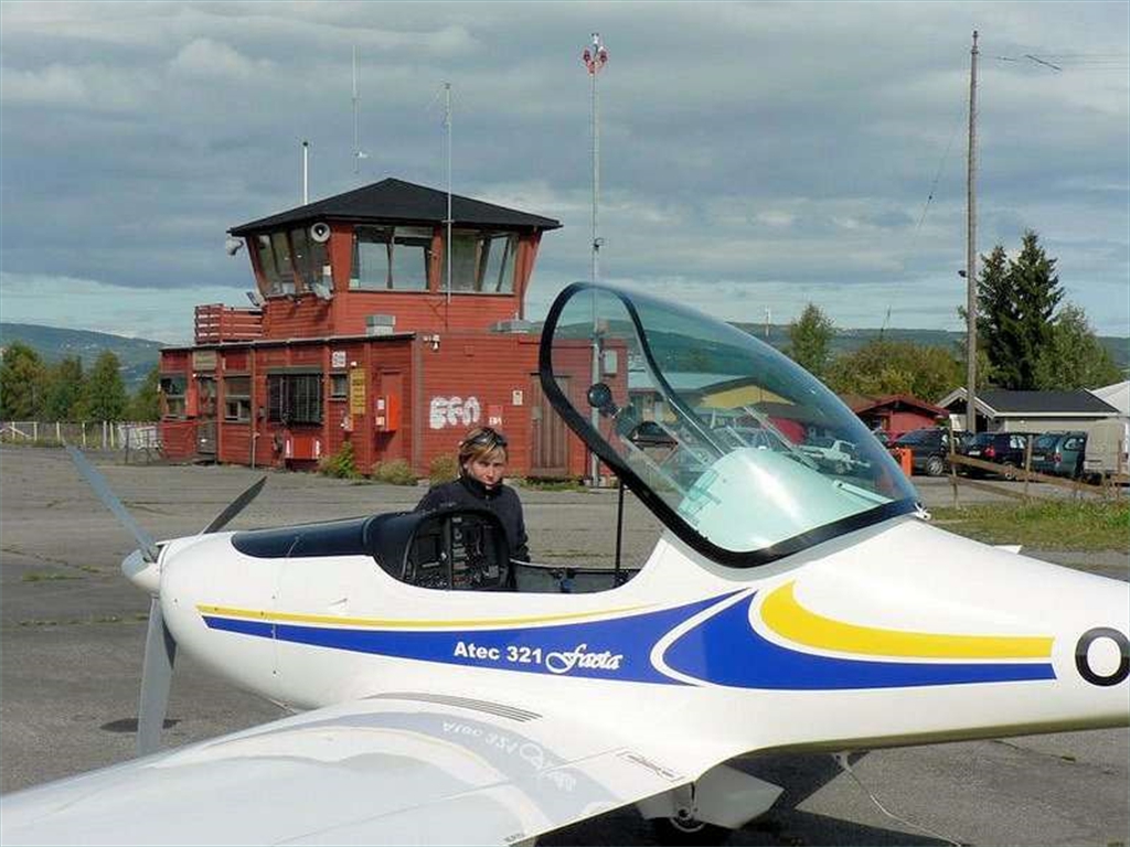


Faeta´s northern flight expedition
UL Faeta´s flight around Scandinavia
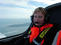
performed by Petr Volejník and Klára KudrnováFirst of all, we would like to say big THANK YOU to our scandinavian friends who helped us to realize such an amazing expedition around their wonderful countries and enabled us to spend a pleasant stay in their home.
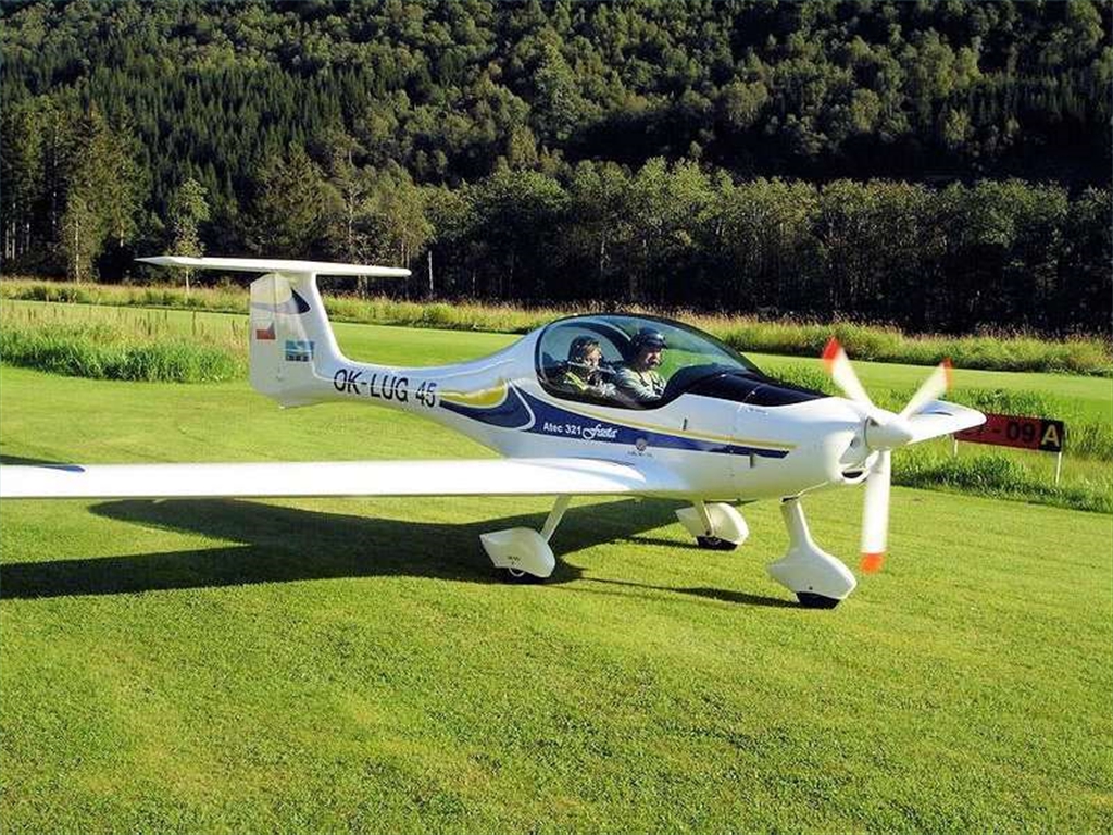
The object of our trip wasn´t to conquest the north pole and to break records. We used our plane for fast, safe and economical tourism. Flying in Sweden and Norway is certainly the worth experience and scandinavian airports are well equipped to make it comfortable. In total, we had been flying for 16 days, 31hod. 45min and passed the route of 5875 km. The GPS displayed an average speed of 185 km/h with an average consumption of 12,6 l/hod. So another „test" of our aircraft´s reliability passed very well.
1. stage - Sweden
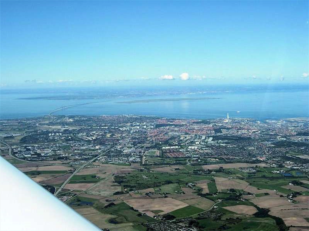
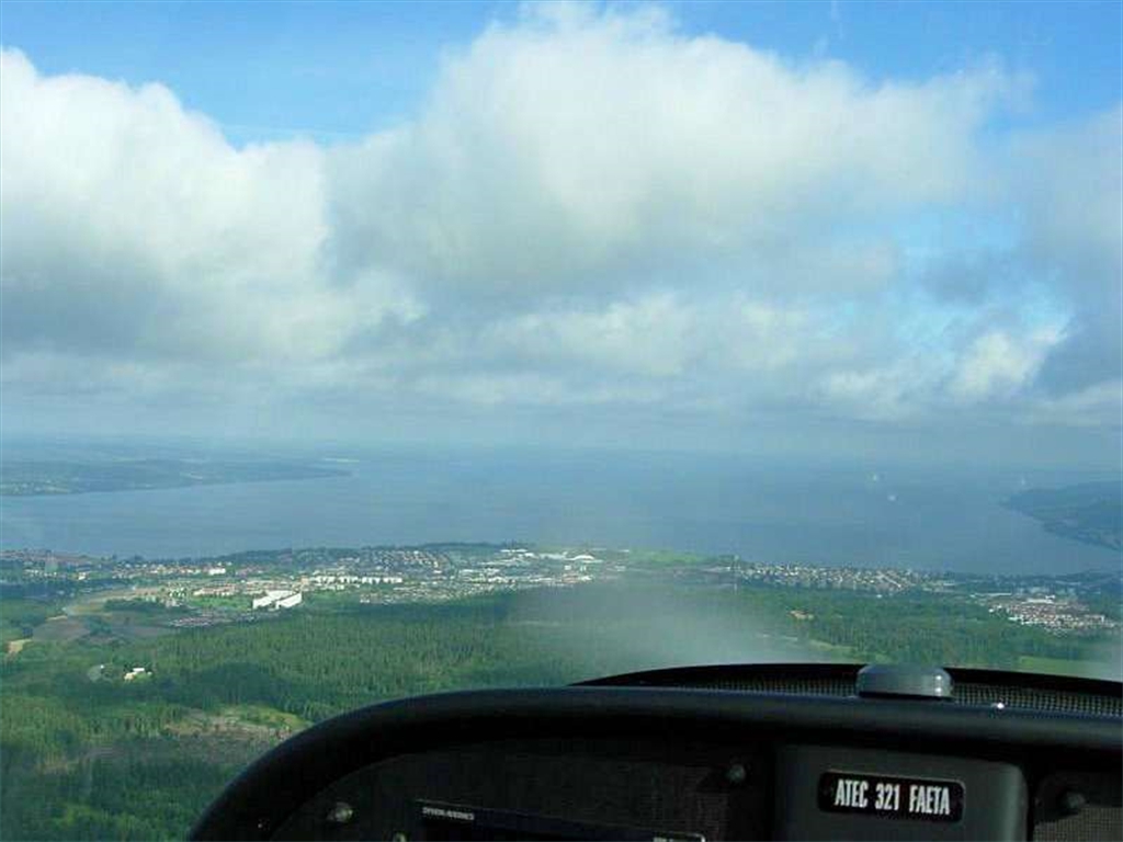
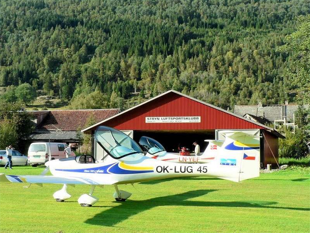
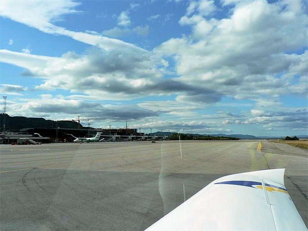
The flight and visit of our friends (and our aircrafts owners as well) in Scandinavia was originally planned for the month of June as we were supposed to participate the GAP aviation meeting in Elverun, the biggest UL meeting in Norway. Unfortunatelly, the weather wasn´t friendly to us, so we decided to put our flight off till a later date. Just only to search for the scandinavian aeronautical maps is an adventurous action. Finally, we reach them from our swedish and norwegian friends. Especially the norwegian aeronautical chart is a big rearness also for local pilots, so they mostly use military charts, sometimes „historical". We finally took-off in the morning on the 30th of August from Czech republic (Nymburk). The sky was clear, no wind, so we flew directly to Sweden - Höganäs AD and finally started the 1st part of our amazing scandinavian trip. After a 700 km, 3 hours and 45 minutes of the flight we landed on the grassy runway in Höganäs AD, havingabout 20 l of fuel in the tank as a rest of 70 l in original.
Expédition nordique en Faeta Atec
L'objet de notre voyage : à la conquête le Pôle Nord et pour établir de nouveaux records. Nous avons utilisé notre avion pour le tourisme rapide, sûr et économique. Voler en Suède et en Norvège est certainement une expérience enrichissante et les aéroports scandinaves sont bien équipés pour la rendre confortable. Au total, nous avions volé pendant 16 jours, 31 heures 45min et parcouru 5875 kilomètres. Le GPS a montré une vitesse moyenne de 185 km/h avec une consommation moyenne de 12.6 l/h. Un test que notre ULM a très bien réussi.
1. étape - Suède
Le vol et la visite de nos amis (propriétaires d'autres Avion ATEC) en Scandinavie avait été prévus à l'origine pour le mois de juin pendant que nous étions censés participer à la réunion d'aviation de GAP à Elverun, la plus grande réunion d'ULM en Norvège. Vu la mauvaise Météo à cette époques nous avons décidé de remettre notre vol jusqu'à ce qu'une date ultérieure.
Rechercher seulement les cartes aéronautiques scandinaves est une action aventureuse. Finalement nous les avons reçu de nos amis suédois et norvégiens. Particulièrement les cartes aéronautique norvégiens sont également très difficile à trouver même pour les pilotes locaux, ainsi ils emploient, la plupart du temps, les cartes militaires, et parfois les cartes "historique ".
Nous avons finalement décollé le matin, 30 août, de la République Tchèque (Nymburk). Le ciel était clair, aucun vent, ainsi nous avons volé directement vers la Suède ( Höganäs) et commencé la 1° partie de notre voyage scandinave. Après 700 kilomètres, 3 heures et 45 minutes du vol plus tard que nous avons débarqué sur la piste en herbe du terrain de Höganäs, il nous restait environ 20 l de carburant dans le réservoir (dès 70 l du départ).

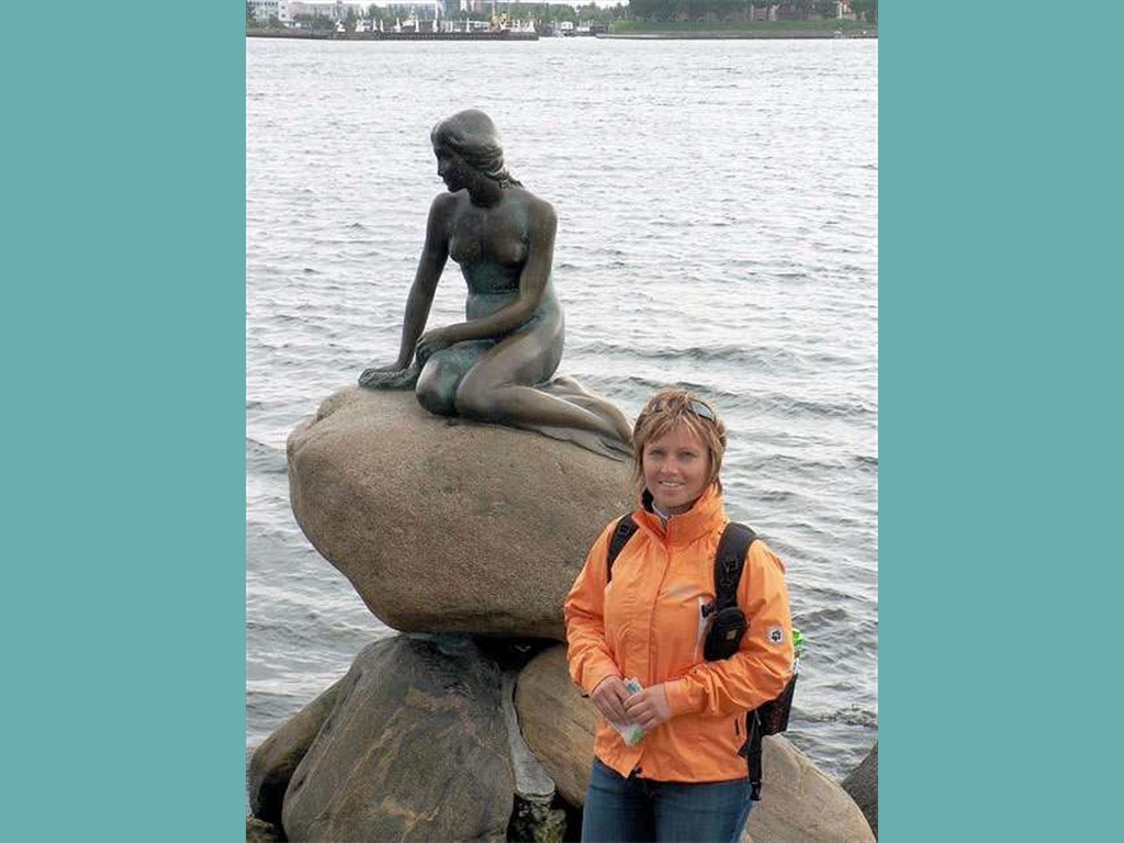
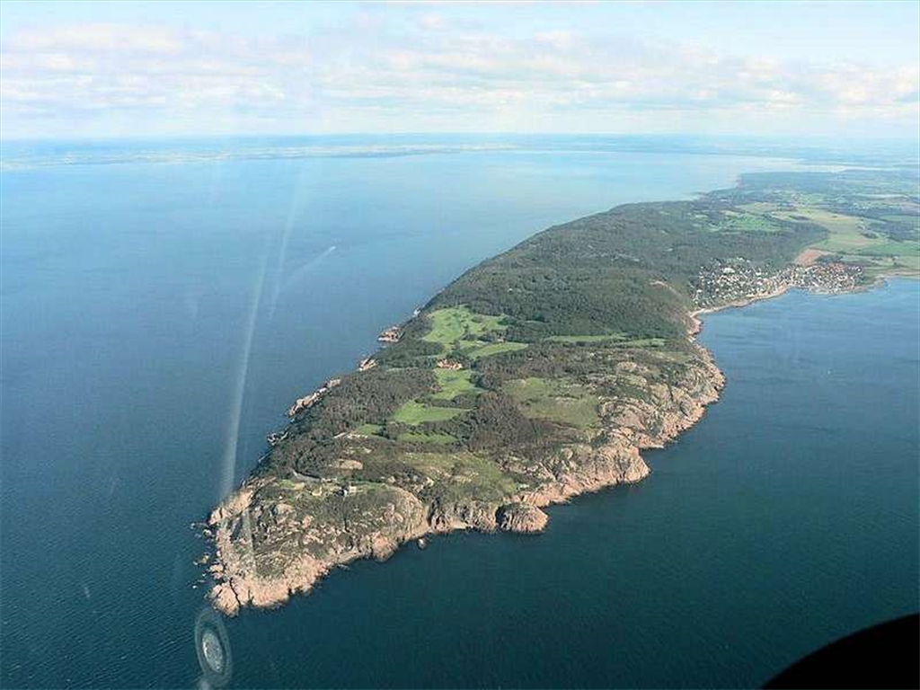
After being friendly welcomed, taking lodge just at the aerodrome and landing bicycles (as usual in Sweden, free of charge), we planned flight, boat and ground trips. With our friends Pawel and his wife Beata, on their yacht accompanied with jumping dolphins, we realized our first boat trip to small danish picturesque fishers town called Gilleleje. The next day, we filled a flight plan and flew across the sea to small „seal´s" island called Anholt. After 3 hours of walking round that windy island without meeting any people, we could finally watching a plenty of lovely wild seals. As to have a rest from flying, the 3rd day we took advantage of excellent and comfortable scandinavian public transport and went by bus, boat and train to visit Kobenhagen, the capital of Denmark. We finished our swedish adventure by wonderful flight to Visingsö island, situated in the middle of Vättern, the 2nd largest lake of Sweden. This island represents the traditional swedish culture by typical swedish houses, famous medieval castle and church, all surrounded with the beautiful nature. We discovered this 15km long island on bicycles landed at the local aerodrome as usual.
Après avoir été accueilli amicalement , réservé un logement juste à l'aérodrome et emprunté des bicyclettes (gratuite comme d'habitude en Suède) , nous avons prévu de voyager de vol, en bateau et sur terre. Avec nos amis Pawel et son épouse Beata, sur leur yacht accompagné par des dauphins, nous avons réalisé notre premier voyage de bateau vers la petite ville pittoresque Danoise, de pêcheurs, appelée Gilleleje.
Le lendemain nous avons rempli le plan de vol et nous avons volé au dessus la mer vers l'ile " Anholt " . Après 3 heures de marche autour de cette île venteuse sans rencontrer aucune personne, nous avons finalement observer une abondance de beaux phoques sauvages.
Le 3ème jour, repos, nous avons tiré profit des excellents et confortables transport en commun scandinave et nous sommes allés en autobus, puis en bateau et ensuite en train visiter Kobenhagen, le capital du Danemark.
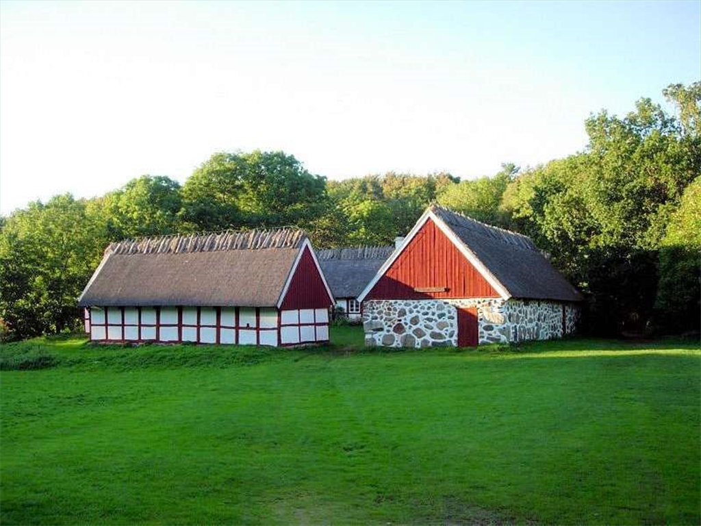
Nous avons fini notre aventure suédoise par un vol merveilleux vers l'île de Visingsö, située au milieu de Vättern, le 2ème plus grand lac de Suède. Cette île représente la culture suédoise traditionnelle par les maisons suédoises typiques, les châteaux médiévaux célèbres et les églises, tous entourés par une nature luxuriante. Nous avons découvert le Long Island de 15km sur des bicyclettes empruntée à l'aérodrome local comme d'habitude.


2. stage - Norway
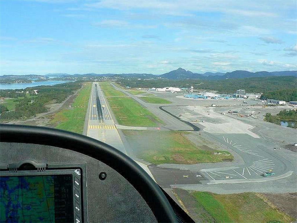
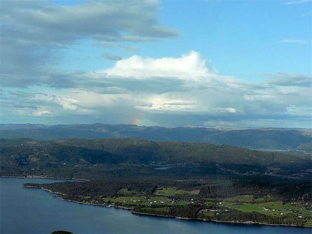
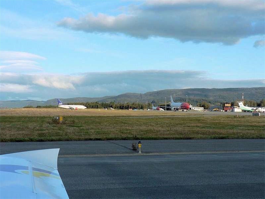
Thursday morning the 4th of September we flew backwind among the swedish cost to Norway. The flight was planned with one stop at Torp international airport and destination Rakkestad. Just before landing in Torp we had lost our competition with cold front and during pouring rain and bad visibility we landed as the second aircraft on the runway 18. After we found out that the customs procedure is not necessary and the rain stopped, we departed „zigcag between Boeings" and crossing Oslofjord direction Rakkestad.2. étape - Norvège
Jeudi matin, le 4 septembre, nous avons volé , avec le vent arrière) le long de la côte Suédoise vers la Norvège. Le vol a été prévu avec un arrêt à l'aéroport international Rakkestad de Torp. Juste avant d’atterrir à Torp nous avions perdu notre avance sur le front froid, rencontré une forte pluie ainsi qu'une mauvaise visibilité. Nous étions le deuxièmes avions sur la piste 18. Après nous avons découvert que la douane n'était pas nécessaire.
La pluie s'est arrêtée, nous sommes partis en zigzagant entre les Boeings pour survoler Oslofjord vers Rakkestad..

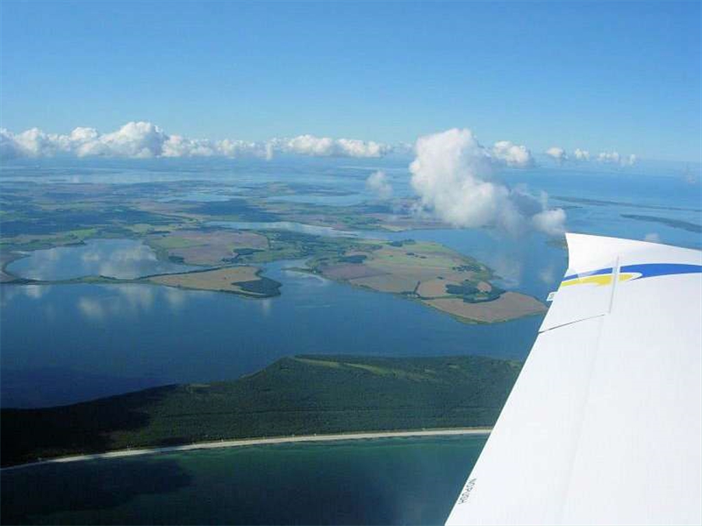
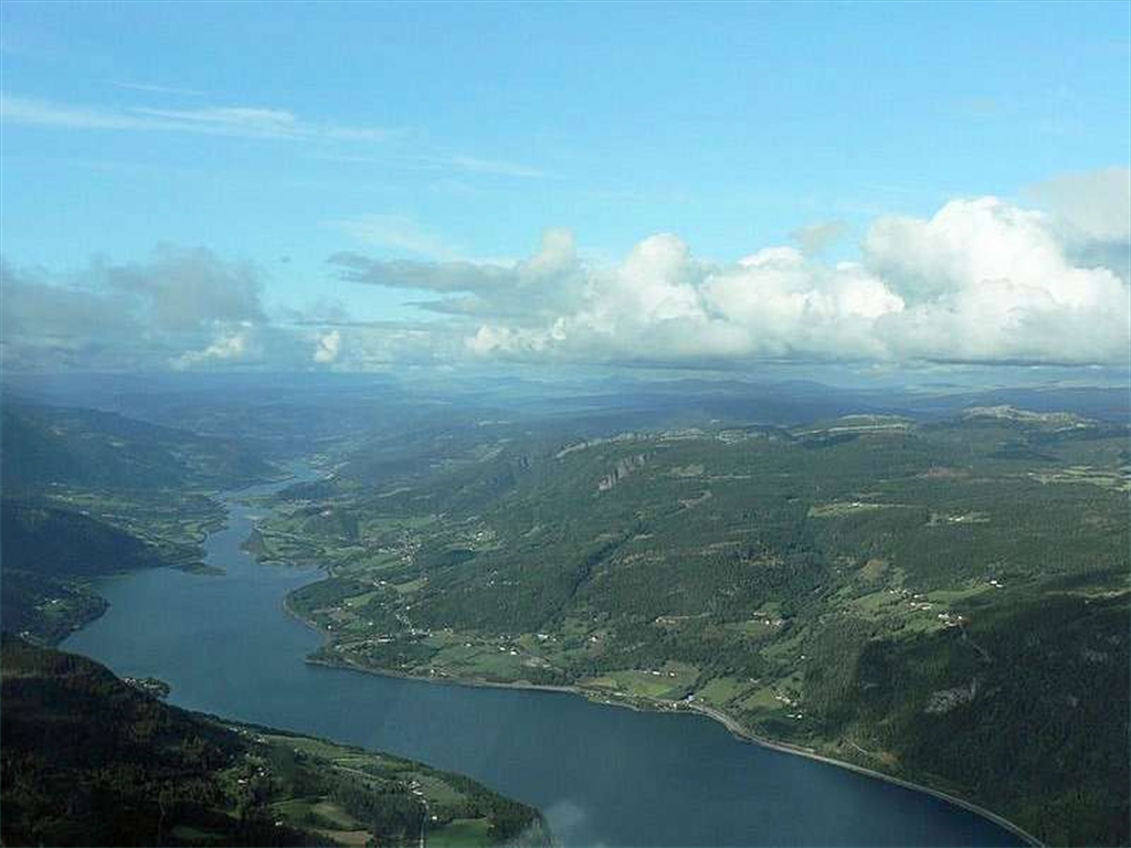
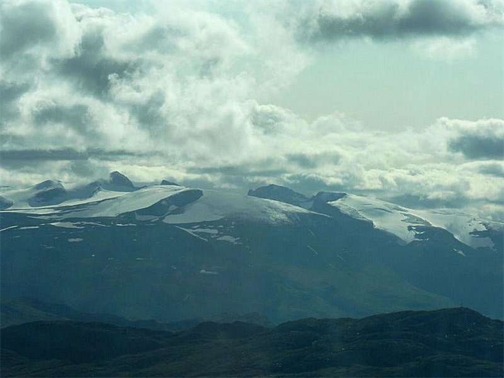
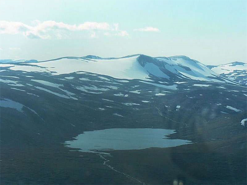
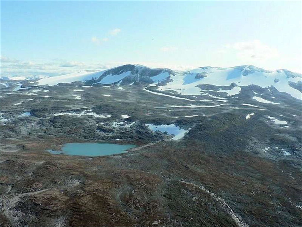
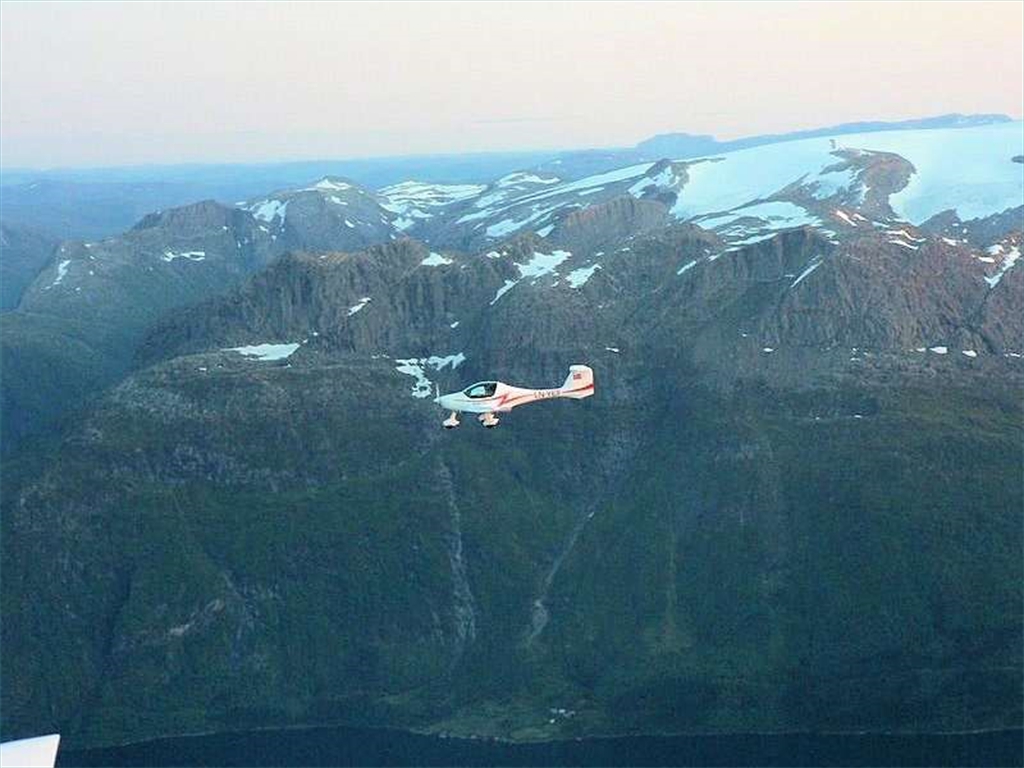
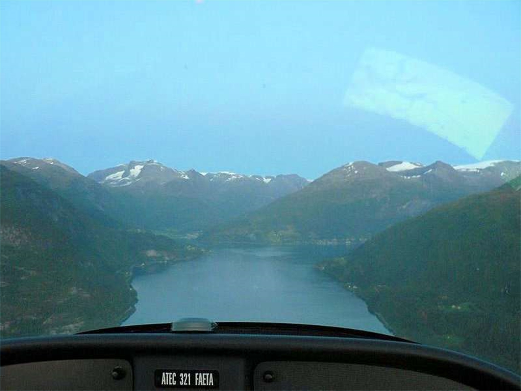
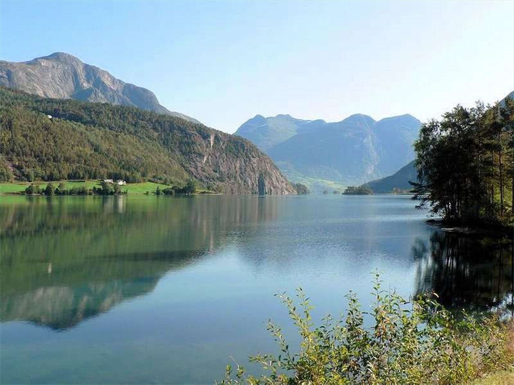
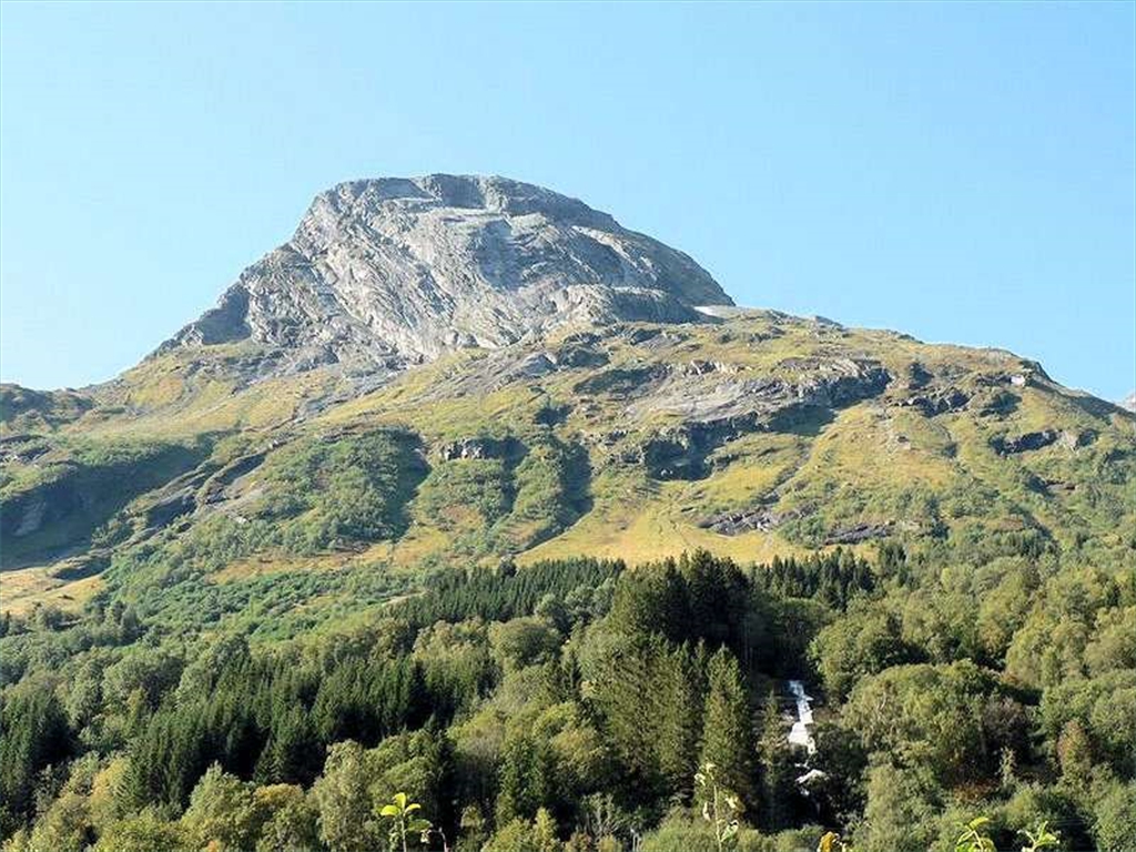
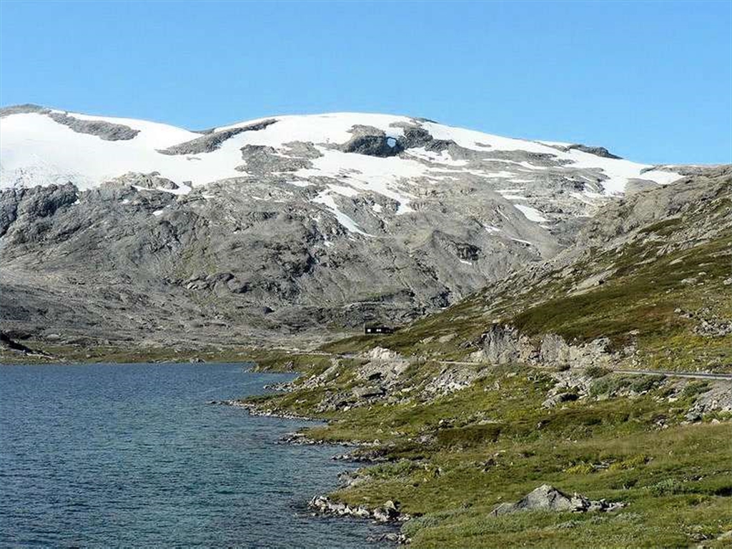
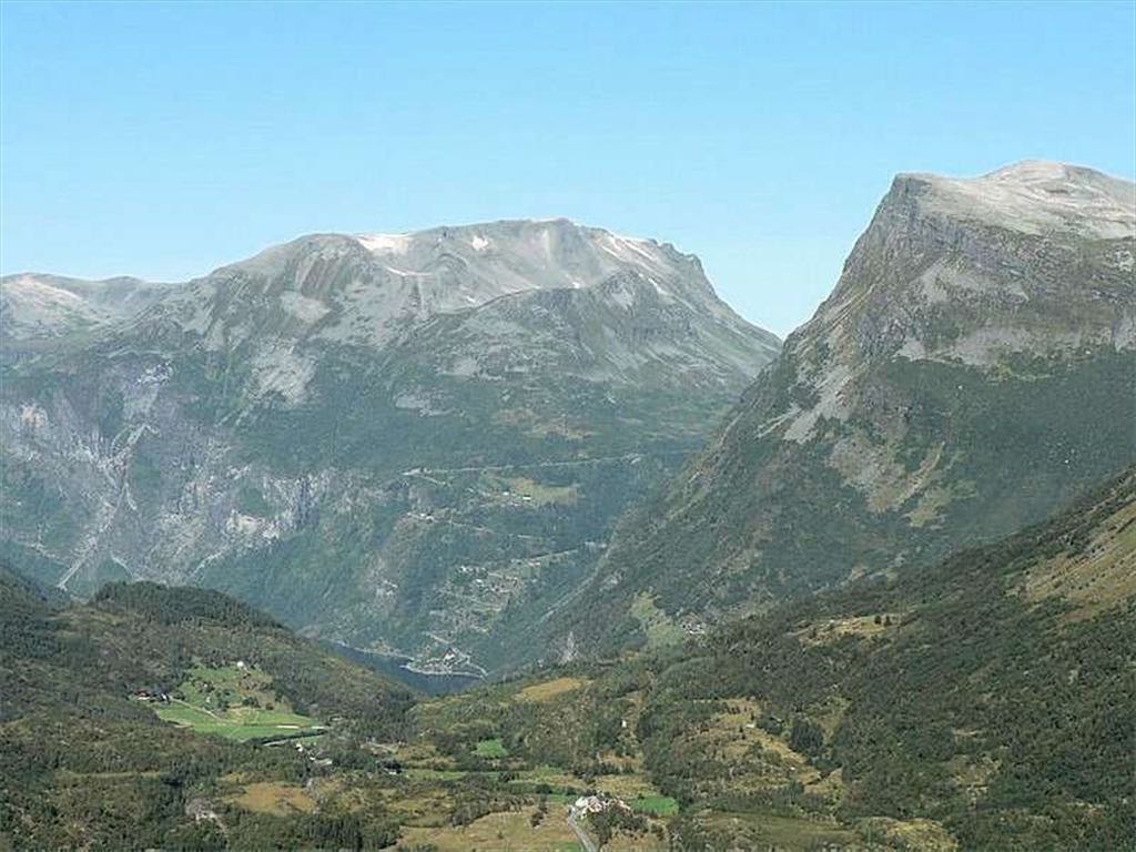
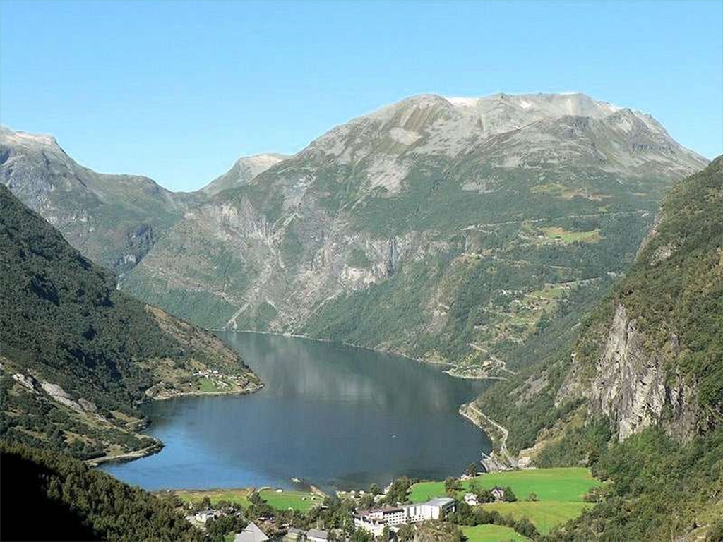
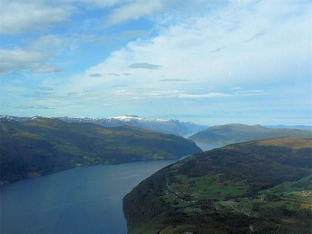
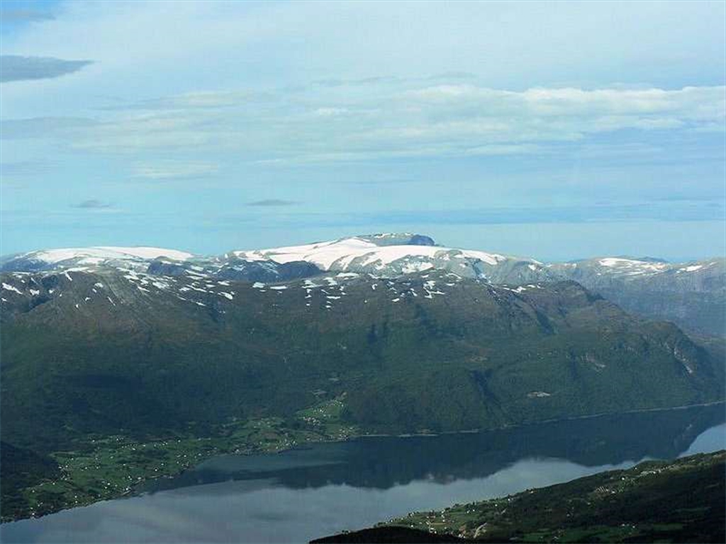
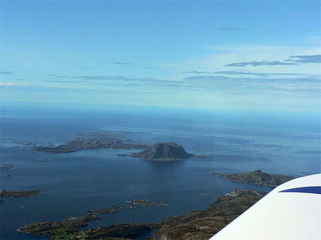
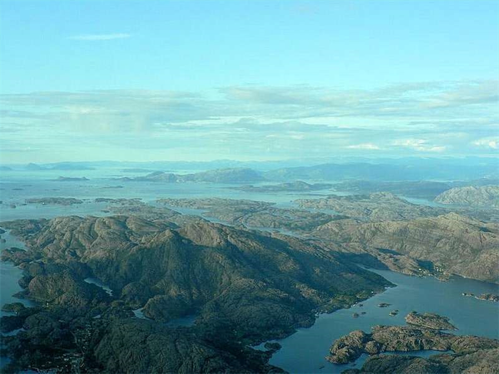
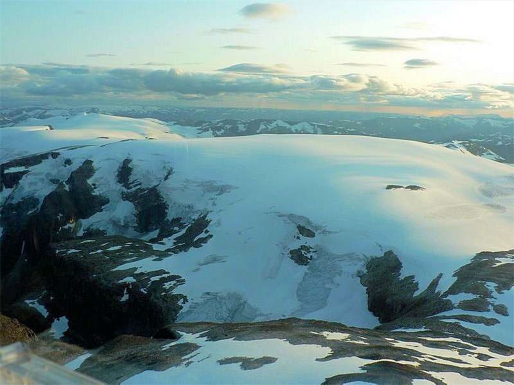
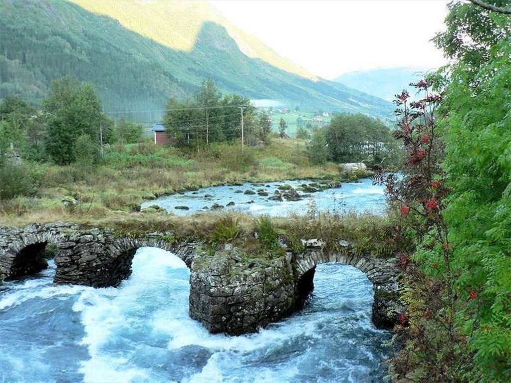
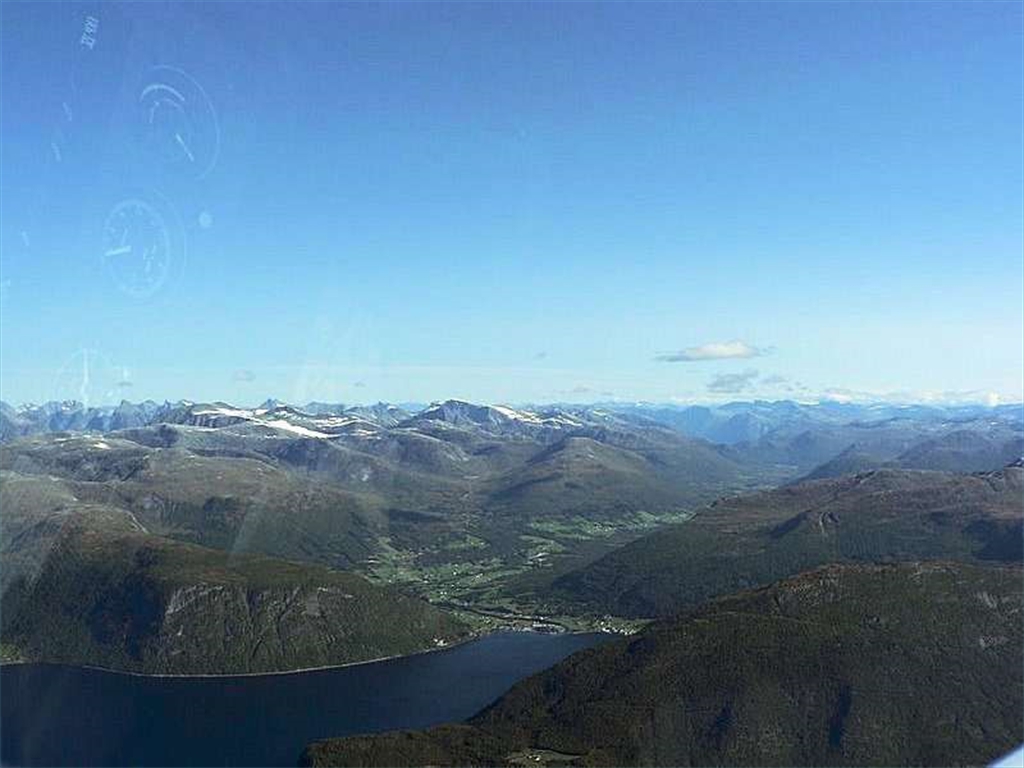
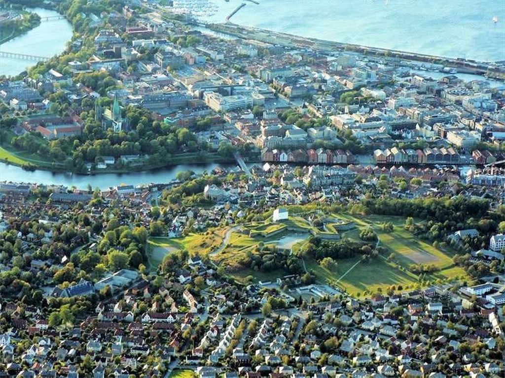
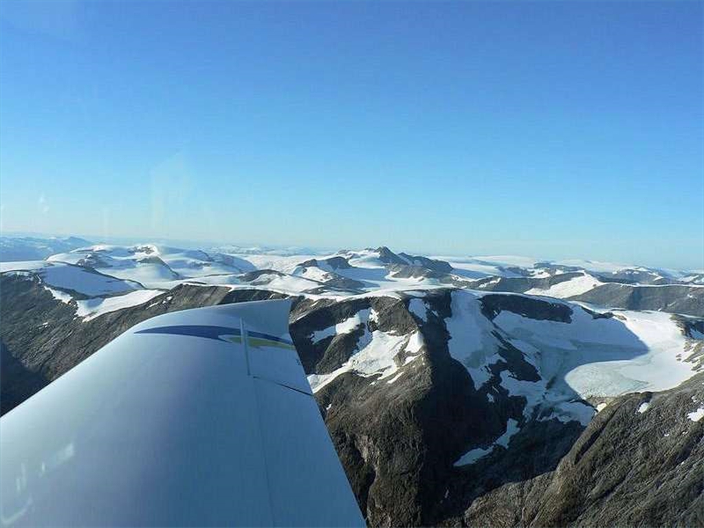
After 2 days relaxing in the cottage of our friend Bjorn (the winner of norwegian UL championship in flying with his Zephyr), which is situated at the sea-coast of Oslofjord, we started the last stage of our flight. During the light rain and clouds base of 1000ft we departed direction Hamar. In this olympic town we met our friends Ole Anton and Jan with their Zephyrs. Ole accompanied us to his home, the town of Stryn, where we spent the rest of our adventurous trip. The weather was much more better than before, so there was nothing to discourage us from continuing to north-west to see the highest part of Norway with its highest peak Galdhøpiggen (2469m) and the area of the largest continental glacier called Jostedalsbreen.
Après 2 jours de relaxation dans la maison de notre ami Bjorn (le gagnant du championnat norvégien d'ULM avec son Zephyr), située au littoral d'Oslofjord, nous avons commencé la dernière étape de notre voyage. Avec une pluie légère et la base de nuages à 1000ft, nous sommes partis direction Hamar. Dans cette ville olympique nous avons rencontré nos amis Ole et Jan Anton avec leurs Zephyr. Ole nous a accompagné à sa maison dans la ville de Stryn, où nous avons passé le reste de notre voyage aventureux. Le temps s'est fortement amélioré, il n'y avait rien pour nous décourager de continuer vers nord-ouest pour voir la région la plus élevée de la Norvège avec son sommet "Galdhøpiggen" (2469m) ainsi que le secteur du plus grand glacier continental appelé "Jostedalsbreen".


")

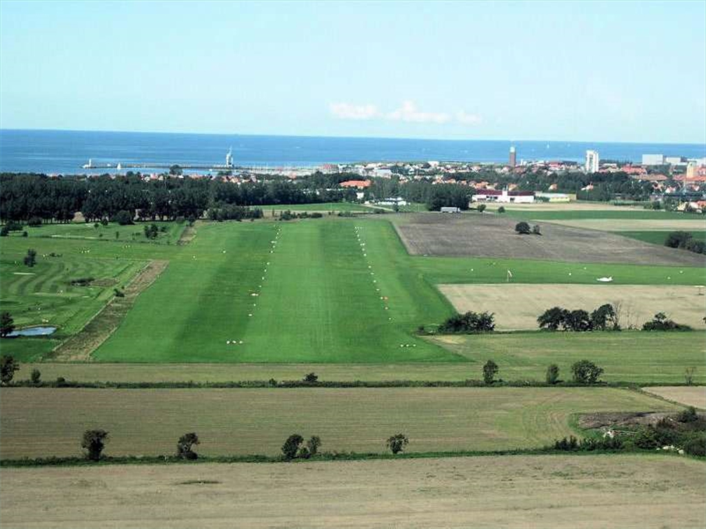
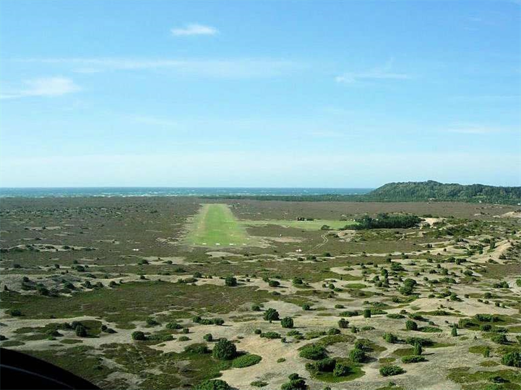
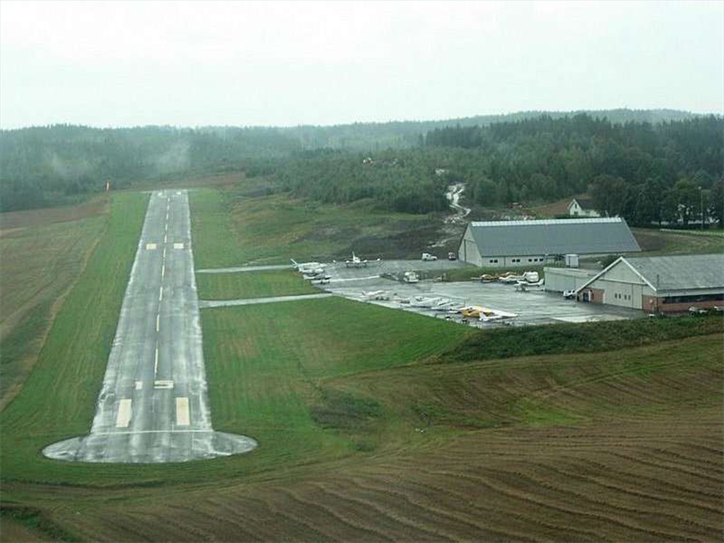
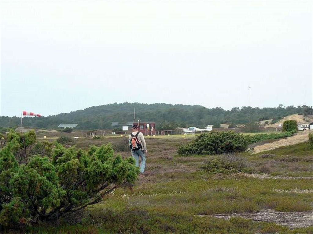
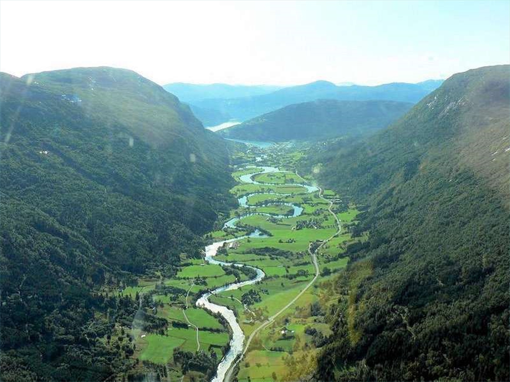
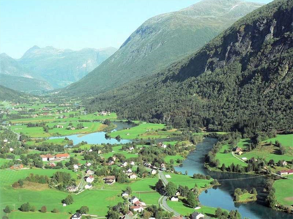
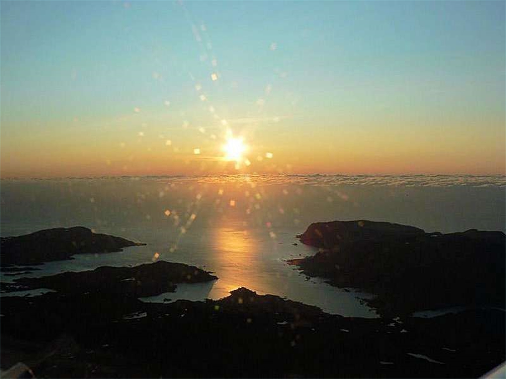
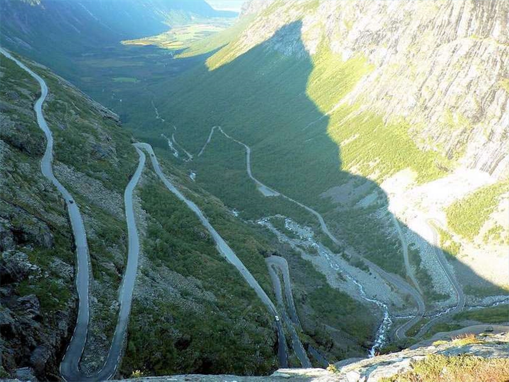
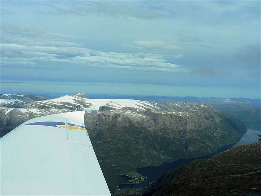
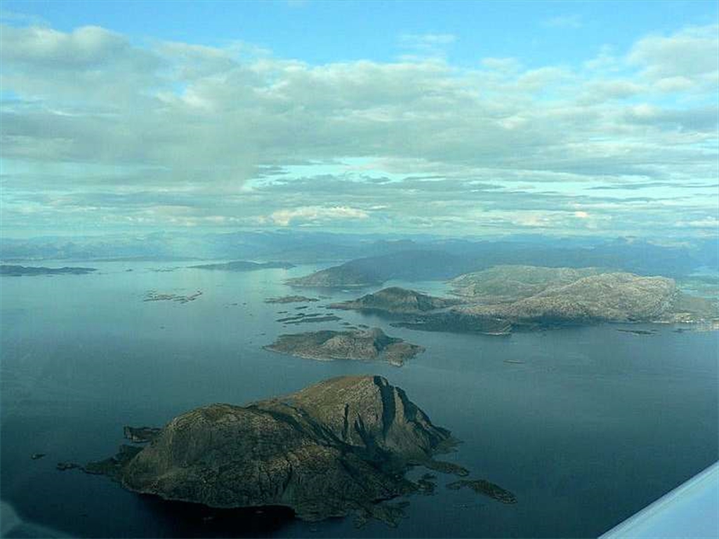
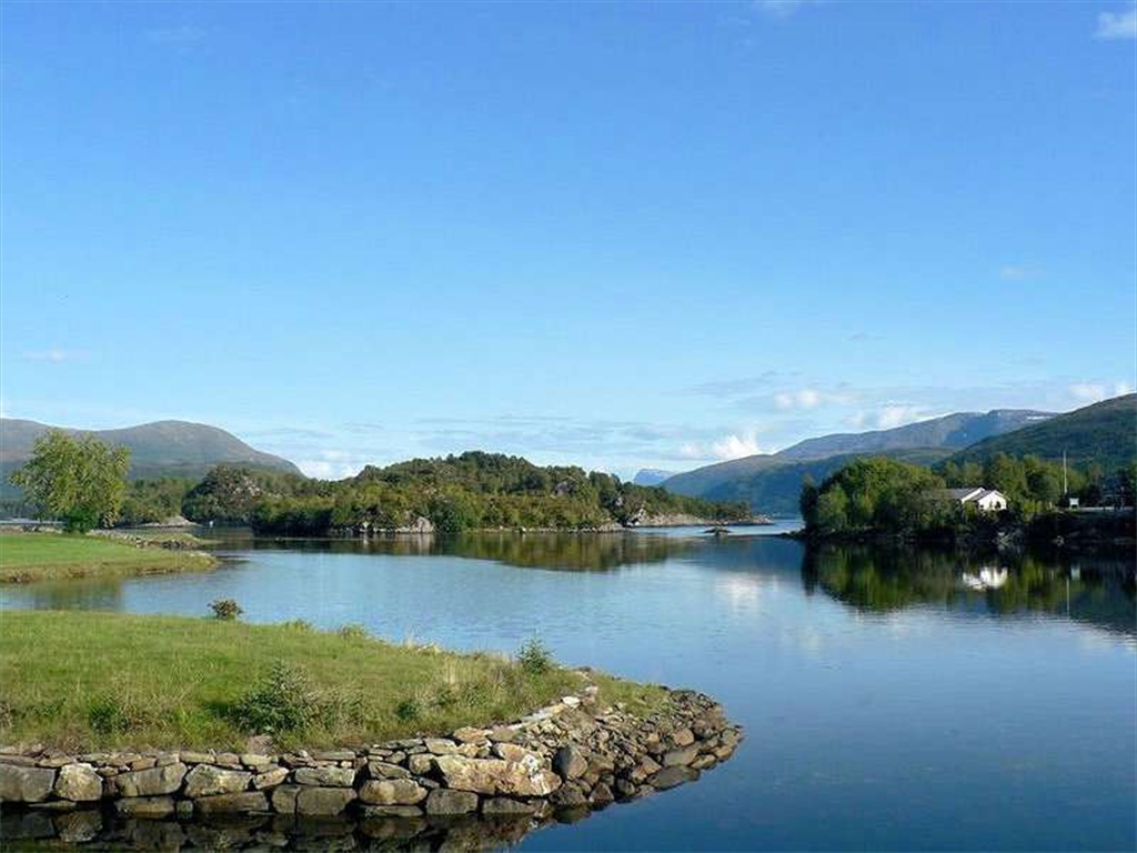
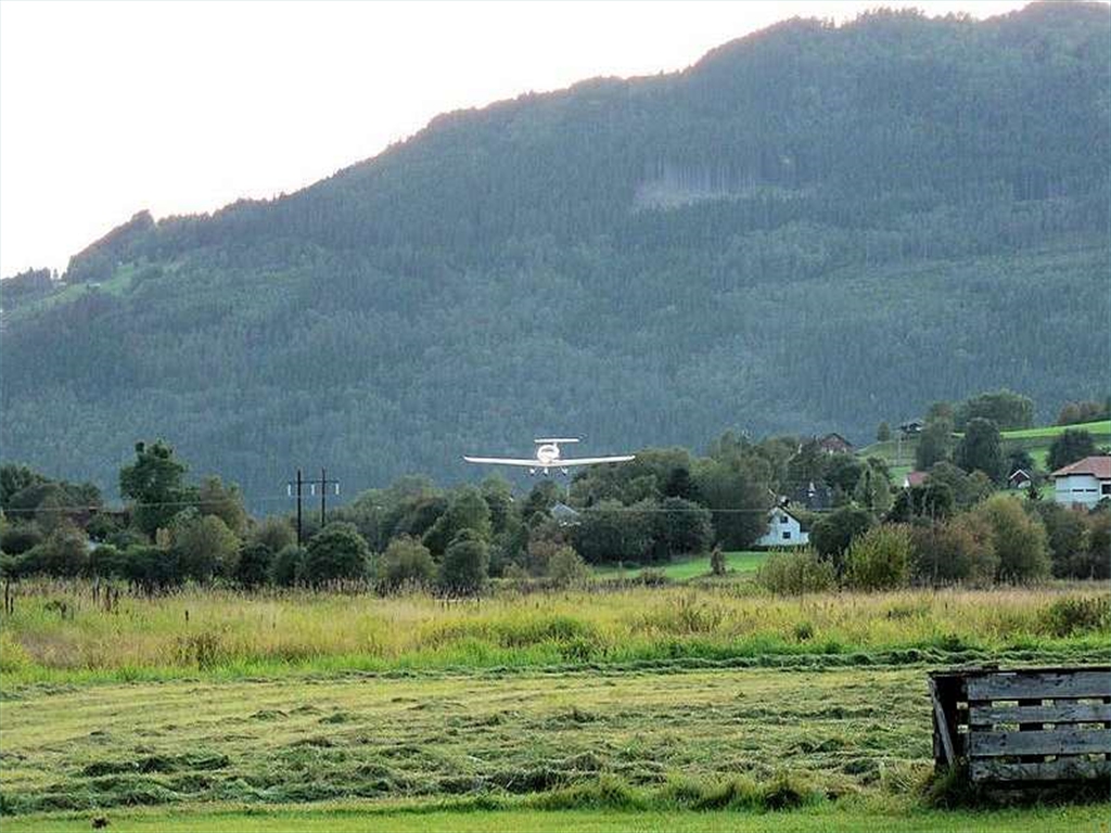
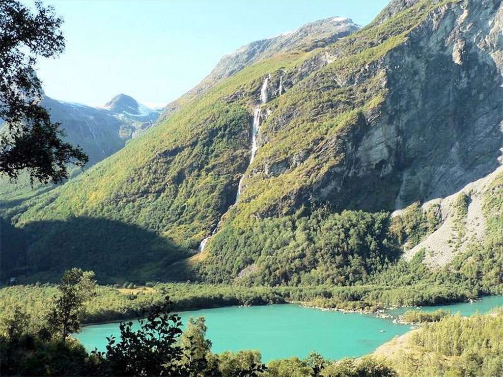
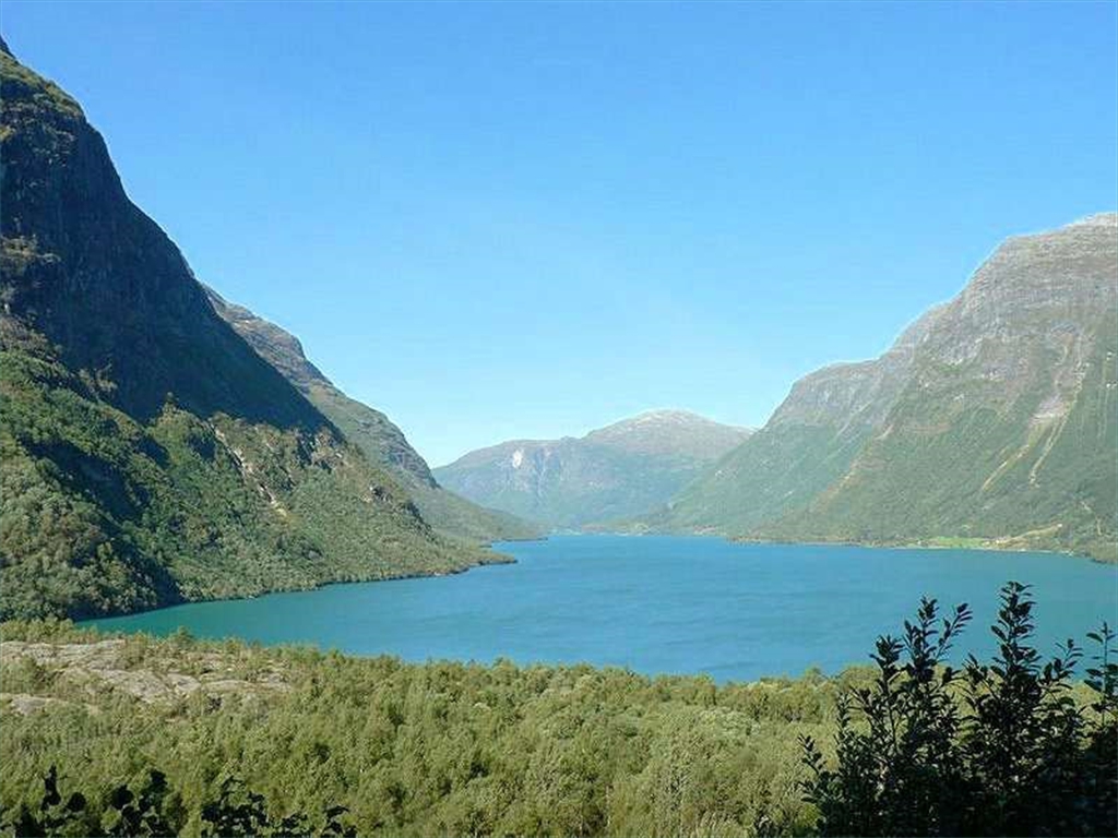
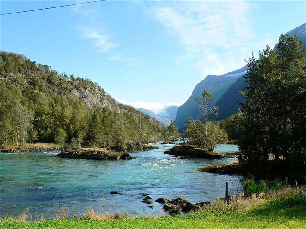
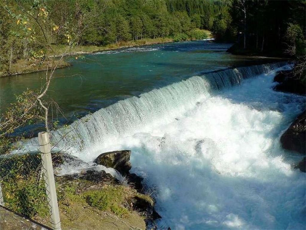
After 1 hour 30 min. of flight above beautiful nature, we finally landed on small „modeller" aerodrome of Stryn, where some few domestic UL planes are tolerated to land. The grassy runway, enclosed between high mountains with waterfalls, is only 280 meters long and cold winding river flows on its both ends. This aerodrome became our home for one nice week. We got used to aerodrome conditions early and its short runway didn´t cause any problems to our Faeta having stall speed of 58 km/h. Just that first evening, we decided to see more of fascinating fjords, glaciers, waterfalls and lakes under evening sunshine, so we left (with a heavy heart) the „welcome barbecue" and 1 hour before sunset we took-off again to discover all Nordfjord to the coast of Atlantic ocean. We could really certify that we stayed in the heart of Norway.
Après 1 heure 30 mn de vol au-dessus de cette belle nature, nous avons finalement débarqué sur l'aérodrome de "Stryn", où seulement quelques ULM sont tolérés. La piste herbeuse, comprise entre de hautes montagnes, des chutes d'eau, le long d'un fleuve, est de seulement 280 mètres de long..
Cet aérodrome est devenu notre maison pour une semaine agréable. Nous nous sommes habitués à ce type d'aérodrome avec une piste courte, notre Faeta ayant une vitesse de décrochage de 58 km/h.
La première soirée, nous avons décidé de voir plus de fjords, de glaciers, de chutes d'eau et de lacs fascinants sous le soleil tombant, ainsi nous sommes partis (avec un cœur lourd) du barbecue de bienvenue et 1 heure avant que coucher du soleil que nous avons décollé pour découvrir tout le "Nordfjord"de la côte de l'Océan Atlantique. Nous pouvons certifier que nous étions au cœur de la Norvège.


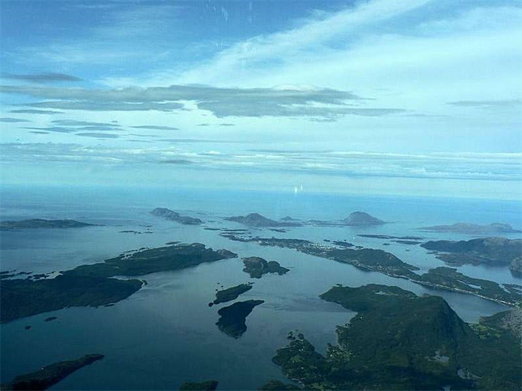
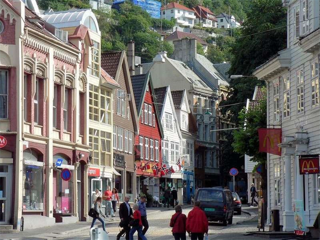
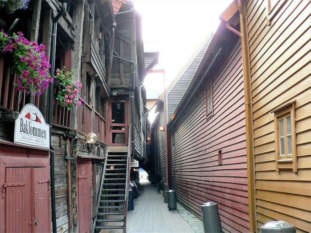
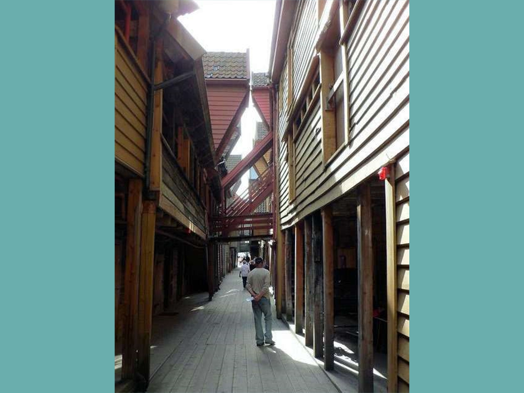
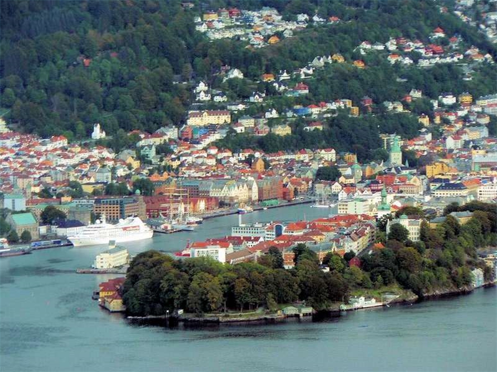
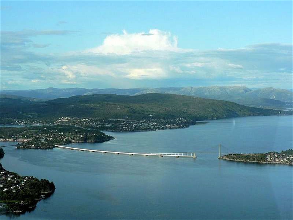
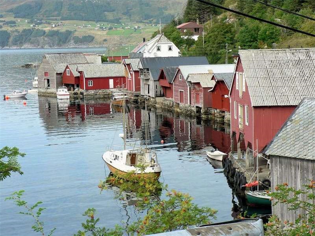
All the sunny week we could discover this nice part of the country and realize the flight trips to Bergen and Trondheim and also many others by car and boat.
Toute la semaine fut ensoleillée, nous avons put découvrir cette belle partie du pays et réaliser les voyages en vol vers Bergen et Trondheim, également beaucoup d'autres en voiture et bateau.


3. stage - flying home
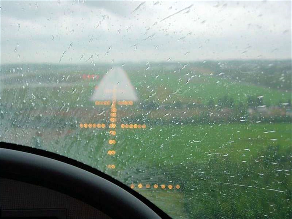
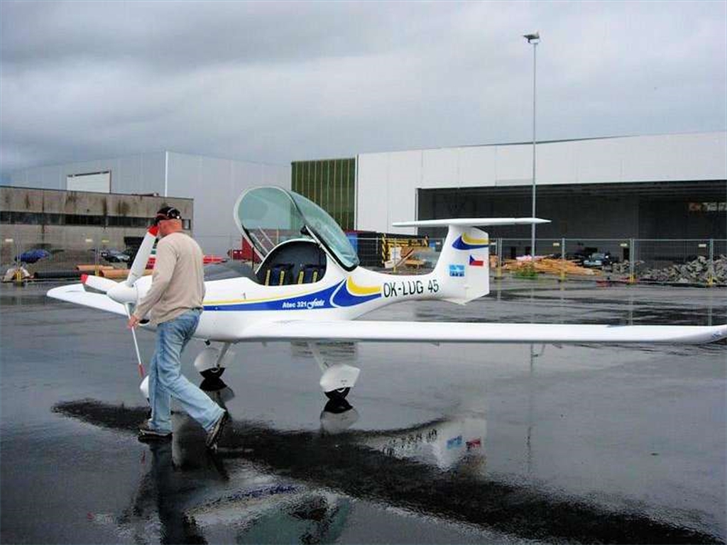
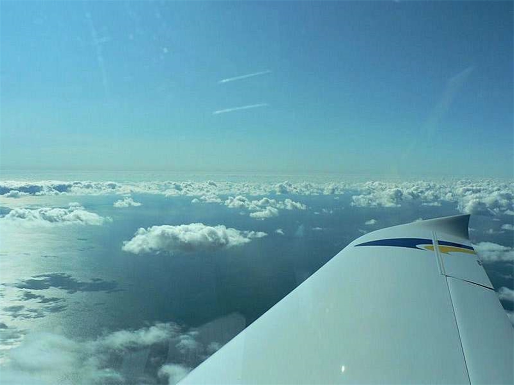
Once everything must end and we planned the flight home. Due to a stiff head wind, we had to change the original plan, which was to fly above the coast to Kristiansand and then to Denmark. The new plan was to fly inland with one stop in Torp, which we already knew well and then to continue via Höganäs again. As we found out later, this alternate plan was the best solution. After the stopover in Torp, we landed in swedish Höganäs afternoon. Even thought the sky was clear, we were too tired after 6 hours of flight. We decided to delay the 700 km´s way home to Sunday morning and stayed overnight in Höganäs. Lately, this decision turned out as wrong, but we had no choice.. Sunday morning, after we had put away the ice off the plane, we hurried up to depart before the cold front, which went unusually from Austria to northern Czechia, will have crossed our way. The conditions for take-off at 8:00 a.m. were ideal. We consulted all with the forecast service to be sure that all aerodromes announced CAVOK. Everything went well by the time we had passed about 100 km over Baltic sea. For the first time, after 2 weeks of flying on nice weather, just in front of German coast we had to turn back to Sweden and cancel the flight plan. Low clouds base and pouring rain forced us to land at the nearest swedish aerodrome. The same situation repeated once more. The meteorologist made us sure that the rain should stop early and that the problem was not serious. After refuelling, actually assured of the clouds base in 300m over the German coast, we filled a new flight plan and started up again. The native pilotes clarified us the situation. The influence of cold and humid air which supported us by blowing to our back paradoxically stopped us. That is to say that once the air comes to the coast, the cloudiness precipitates and the rain starts. Some pilots underestimated that conditions... Finally, the conditions didn´t change so we had to plan the flight over Denmark and german Lübeck. We succeeded with this last route, althought we had to „zigzag" between the clouds again as far up as home aerodrome in Nymburk.3. étape - vol de retour
Tout dois avoir une fin ...et nous avons prévu le vol vers notre base. En raison d'un fort vent principal, nous avons dû changer le plan original, qui était de voler au-dessus de la côte " Kristiansand "et puis au Danemark. Le nouveau plan est de voler à l'intérieur avec un arrêt à "Torp", pour continuer vers Höganäs.
Comme nous l'avons découvert plus tard, ce plan alternatif était la meilleure solution. Après l'escale à Torp, nous avons atterri l'après-midi à Höganäs.
Même que le ciel était clair, nous étions trop fatigué après 6 heures de vol pour continuer. Nous avons décidé de retarder le vol vers notre base
distante de 700 km´s au dimanche matin et sommes restés dormir à Höganäs.
Dimanche matin, après que nous ayons enlevé la glace se trouvant sur notre ULM, nous nous sommes dépêchés de partir avant l'arrivée du front froid, qui s'étalait de l'Autriche jusqu’au nord de la république Tchèque.
Les conditions pour le décollage à 8h du matin étaient idéales. Nous avons tout consulté avec le service de prévision MTO pour être sûrs que tous les aérodromes étaient annoncés CAVOK.
Tout s'est bien passé pendant le survol, de 100 km, au-dessus de la mer baltique. Pour la première fois, après 2 semaines de vole et de beau temps, juste devant la côte allemande nous avons dû nous détourner vers Suède et annuler le plan de vol.
La base de bas nuages et la pluie importante nous ont forcés à atterrir à l'aérodrome suédois le plus proche. La même situation s'est répétée une fois de plus.
Le météorologiste nous a assurés que la pluie devrait s'arrêter assez tôt et que le problème n'était pas sérieux. Après réapprovisionnement en combustible, s'être assuré de la base de nuages était 300m au-dessus de la côte allemande, nous avons rempli un nouveau plan de vol et nous sommes reparti. Les pilotes locaux nous ayant expliqué la situation.
L'influence de l'air froid et humide qui nous a poussé, en soufflant dans notre dos, paradoxalement nous a arrêtés. C'est-à-dire qu'une fois que l'air vient vers la côte, l'air devient plus opaque et donne de la pluie.Quelques pilotes ont sous-estimé les conditions…
En conclusion, le changement des conditions de vol nous sommes passé au-dessus du Danemark et du Lübeck allemand.
Nous avons réussi avec cet dernier itinéraire, bien que nous ayons dû zigzaguer encore entre les nuages monter afin de rejoindre notre base " Nymburk".
